- Thumbnail
- Resource ID
- 1dd0c48c-780c-11ea-888b-000c2931b24c
- Title
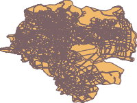
- Addis Ababa city Land Use
- Date
- April 6, 2020, 8:40 a.m., Publication
- Abstract
- Source: GII
Projected Coordinate System: Adindan_UTM_Zone_37
- Edition
- --
- Owner
- tsegaye
- Point of Contact
- Ayele
- tsegayeayele840@gmail.com
- Purpose
- COVID 19 mapping and Analysis
- Maintenance Frequency
- unknown
- Type
- vector
- Restrictions
- formal permission to do something
- License
- Public Domain
- Language
- eng
- Temporal Extent
- Start
- --
- End
- --
- Supplemental Information
- No information provided
- Data Quality
- --
- Extent
-
- long min: 460199.440400001000000
- long max: 489606.096100000000000
- lat min: 976208.153000003000000
- lat max: 1005635.900100000000000
- Spatial Reference System Identifier
- EPSG:20137
- Keywords
- no keywords
- Category
- Planning Cadastre
- Regions
-
Global
,
Africa
,
Central Africa
,
East Africa
,
Ethiopia
,
North Africa
,
Sudan
,
Asia
,
East Asia
,
South Asia
,
Pacific